Data is currently (subject to shutdown delay) at
https://data.giss.nasa.gov/gistemp/tabledata_v4/GLB.Ts+dSST.csv
or
https://data.giss.nasa.gov/gistemp/tabledata_v4/GLB.Ts+dSST.txt
(or such updated location for this Gistemp v4 LOTI data)
January 2024 might show as 124 in hundredths of a degree C, this is +1.24C above the 1951-1980 base period. If it shows as 1.22 then it is in degrees i.e. 1.22C. Same logic/interpretation as this will be applied.
If the version or base period changes then I will consult with traders over what is best way for any such change to have least effect on betting positions or consider N/A if it is unclear what the sensible least effect resolution should be.
Numbers expected to be displayed to hundredth of a degree. The extra digit used here is to ensure understanding that +1.20C resolves to an exceed 1.195C option.
Resolves per first update seen by me or posted as long, as there is no reason to think data shown is significantly in error. If there is reason to think there may be an error then resolution will be delayed at least 24 hours. Minor later update should not cause a need to re-resolve.
ty for your insightful research @parhizj , honestly its fun to read this!
im getting 1.01 +-0.03 atm, it's just uncertain what will happen to the temperatures towards the end of the month - rather than saying theyll increase or decrease compared to the start of the month, im taking more of a neutral stance, i think they'll remain more or less stable +-0.05 for the last week of December
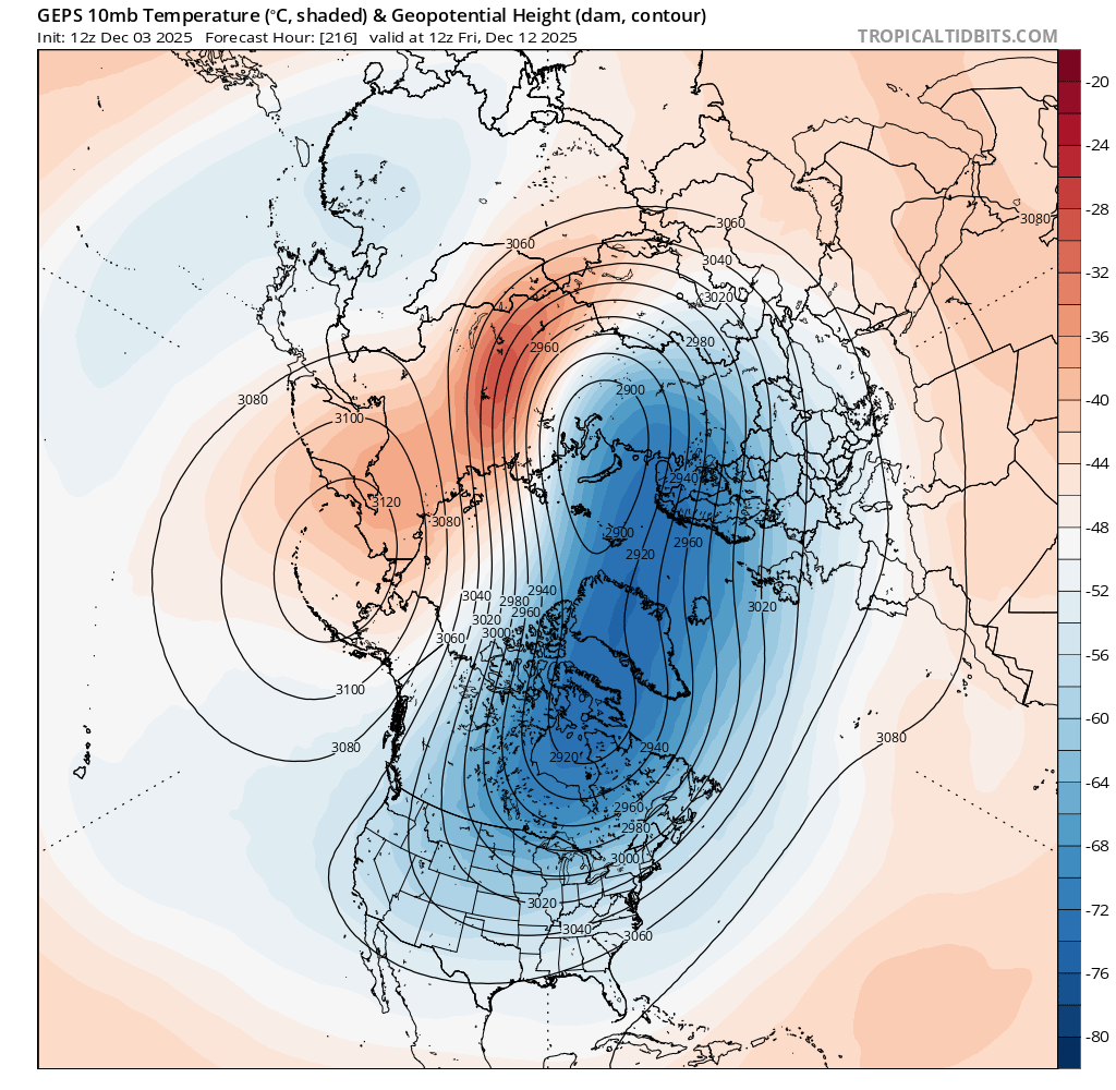
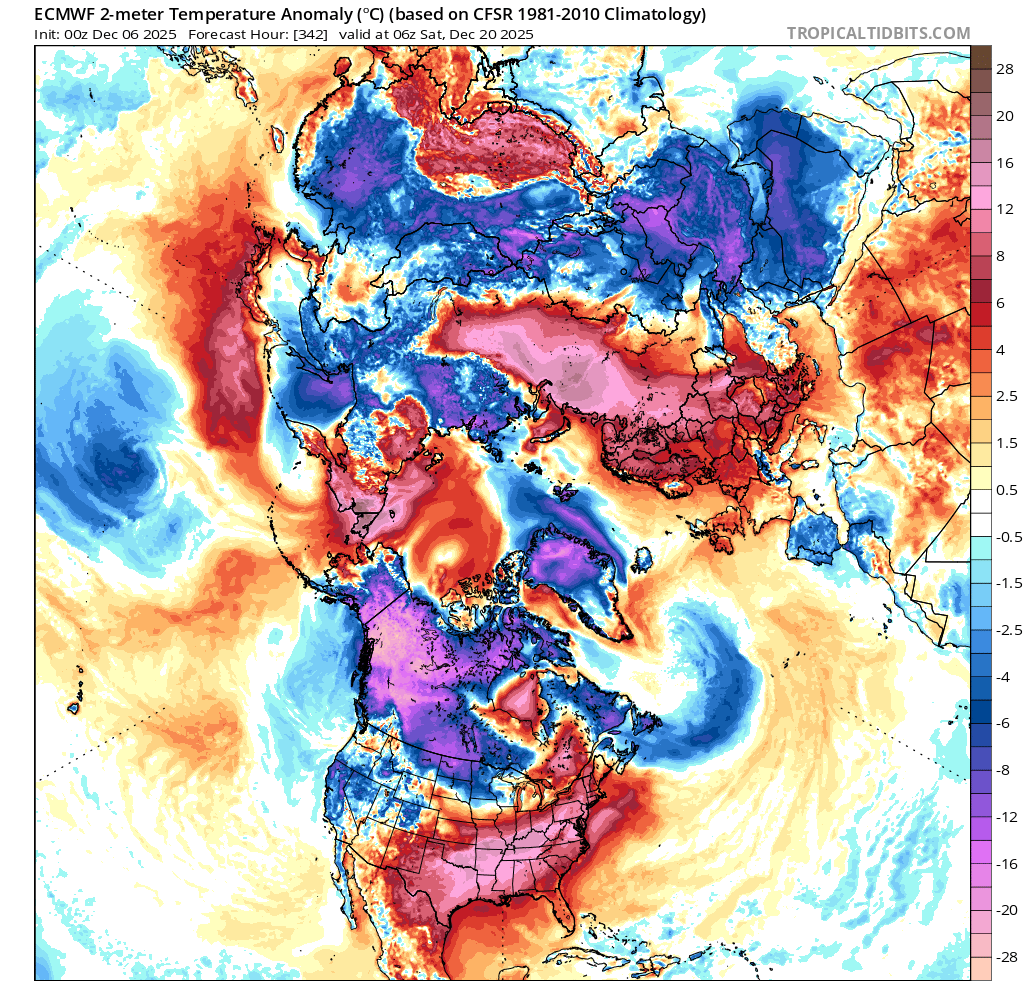
The Arctic SSW forecasted for the end of the last month didn't validate and it ended up as a Canadian Warming instead (resulting in a stretched polar vortex); something similar may happen again seems to be forecast for the middle of the month (although its very far out) with the vortex getting temporarily stretched again (a dip in the stratospheric winds). So at least for the NH I am speculating the second half of December will be roughly as anomalous as the first half of December.
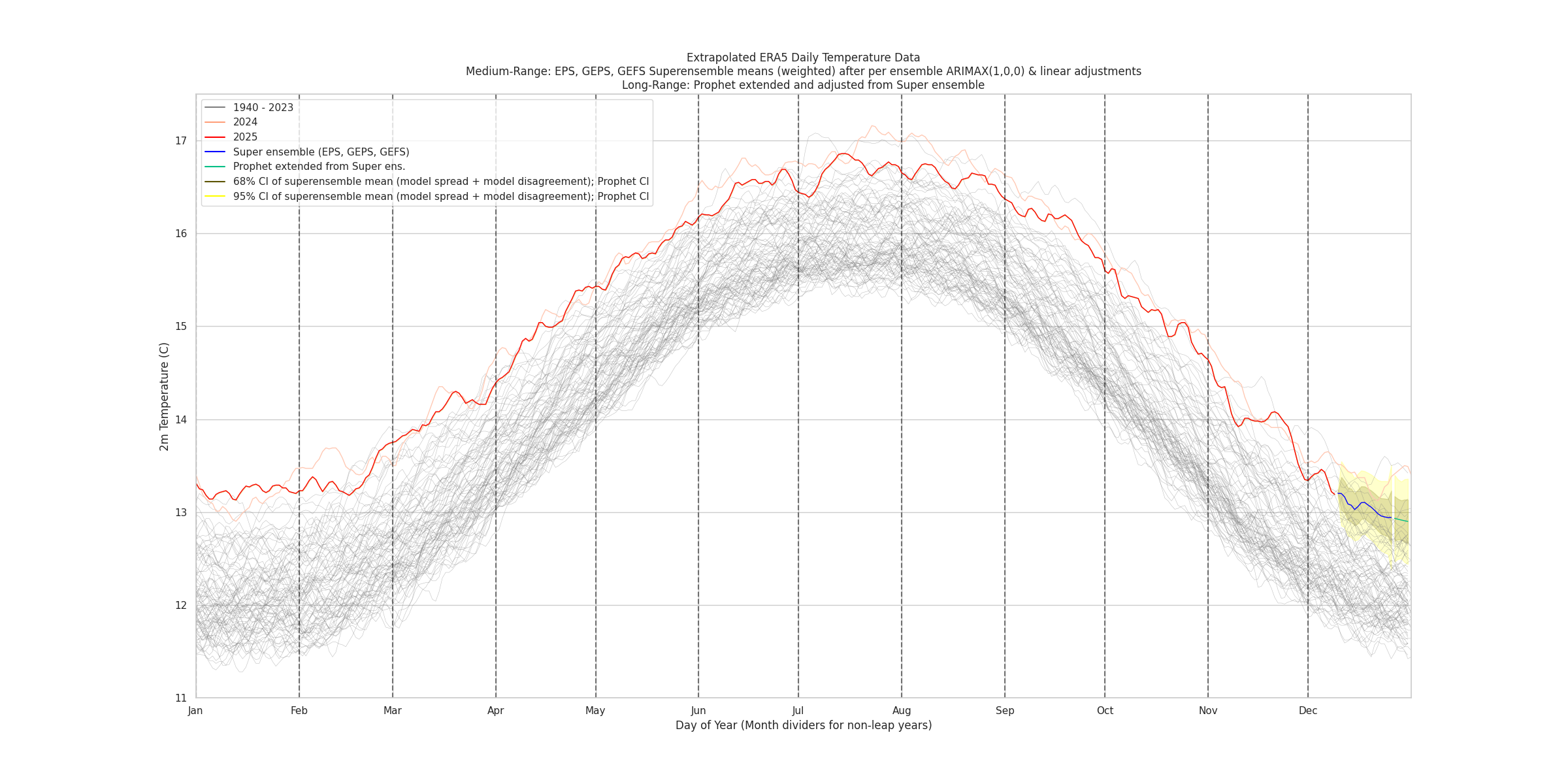
Globally, given the medium range models are anticipating a dip in week 2, I do overall expect roughly even temps for the second half of december when compared to the first half, but more warming compared to Prophet's expectations (below) of a climatological downward trend on average after extrapolating from the dip (i.e. I expect some more reversion than shown below) ...
So overall, I'm expecting the December anomaly to be cooler than November anomaly this time... (edit2) although not official yet, the latest gistemp run I did continued to show a revised October a bit cooler than official (1.192) although this may be still due to a bit sparse data) (and expecting from ERA5 that November to be about the same or a bit warmer).

My priors for large month over dips given that the recent two months have been mostly steady, generally indicate to me that we should expect a modest dip compared to November's anomaly, so I've placed most of my initial bets based around that.
Looked at more subseasonal forecasts and indices today despite them worse than climatology usually on the whole; my interpretation is they still indicate some mild warming for weeks 3-4 of december relative to week 2, which very much still goes against the climatology... (otherwise I should be dumping all my mana in the lowest two bins)....
i.e. binning the climatology you get the following trend relative to some mid point in December (obviously not the best method)
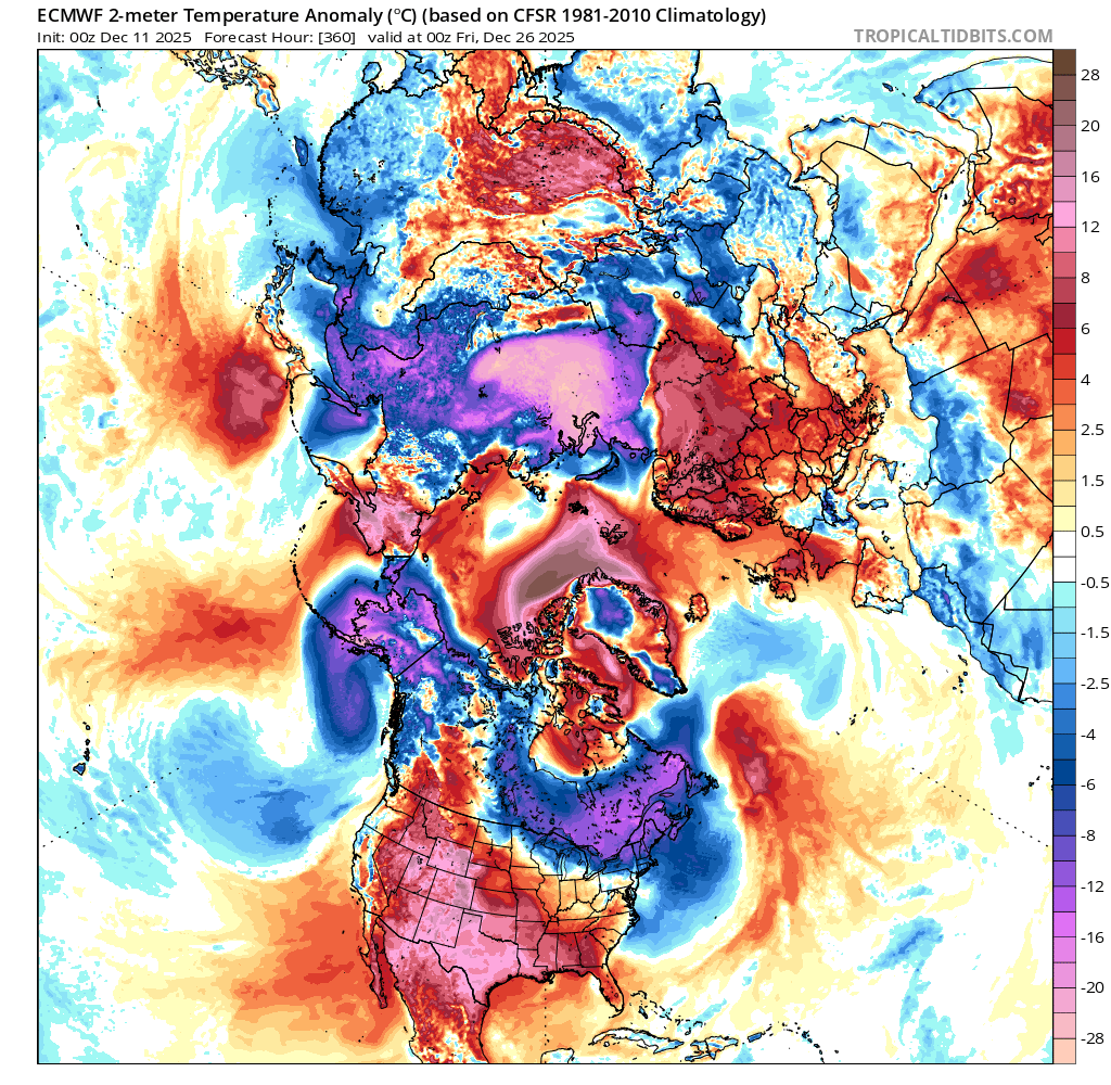
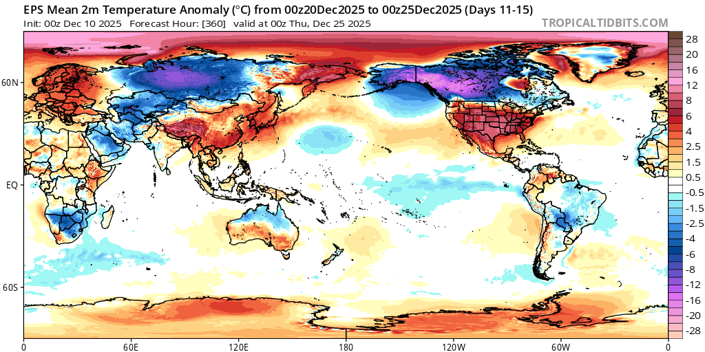
Still looks like this year doesn't have a good analog looking at the other years indicated... The weather for North America at least should be milder than past analogs (with perhaps the exception of the East coast) and still NH anomalies overall as well as some continued Antarctica anomalies seem indicated to continue to dominate in weeks 3-4..
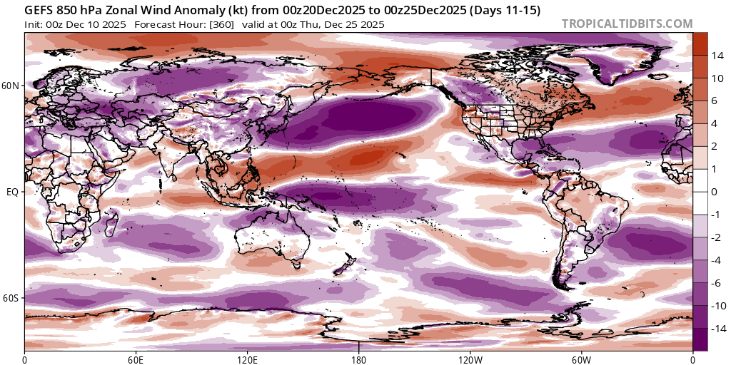
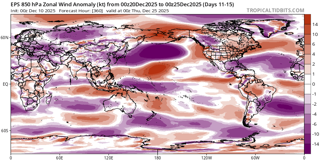
(Referenced ECMWF subseasonal charts as well as GEFS, CFS medium range and long range forecasts).
in short GEFS indicates NAO+, AO+, PNA- for a mild NH winter overall for December (with the exception of possibly east coast), and a continued AAO- for some more Antarctica warm anomalies)
~
In overall the justifications to go against my own (statistical and the usual dynamic medium range superensemble + Prophet) models again (by raising it slightly higher subjectively) are to:
1) rely more heavily on the priors for month to month change in anomalies from gistemp (which counterindicates such a large change, i.e. which would drop us down to 1.09 C after all adjustments for a point prediction, which would seem to be more than a 0.1C drop by my forecast for November, which if I recall should definitely be in a lower quartile if my forecast is correct)),
2) interpretation of the longer range dynamic models despite being less reliable do seem to generally agree on some warming but this is calculated subjectively in part,
3) the climate as of the last few years after the last el nino seems to have less good analogs to the past, so I do want to downplay the climatology to some degree to reflect that despite being in a la nina now...
Unfortunately this means my bets are still largely subjective at this point....

The super ensemble has shifted downwards a bit. I've updated a couple times today (now more downwards) after lastly looking at various diagnostics from only the deterministic ECMWF, subjectively this might have been caused by a change in pattern for Asia, namely a cold front/high pressure bringing a blast of Arctic air to Asia for week 3 of December (where in the 00Z/12Z runs yesterday they didn't show this). EPS isn't in good agreement about this of course so far out so its hard to say if this was definitively the cause....


As the medium range ensembles continue to drop and start covering the last third of the month, they seem to be indicating along the lines of a normal climatological trend - i.e. a reversion to warmer global temps (that I thought was more likely a few days ago) is becoming less and less likely (with the countering possibility that perhaps maybe GEPS forecast is overdoing the cold spell for Asia for week 3) ... As with consecutive days indicating otherwise now, there is less justification in going against my own models so I have updated more strongly in the other direction towards it being in one of the lower two bins, but not entirely so, as the most naive, purely statistical model (that is very sensitive to the last day's temps) indicates as high as 1.18, where as the dynamic models from the super ensemble has been trending down, and is now in the 1.06 or 1.05 range (unbiased, and debiased notebook); that they have been in good agreement for the last few days this far out does give me some slight additional confidence..
~
Given I have high confidence now November's anomaly looks very much to be where I predicted it to be I can say that the prior (for month over month change) for previous bets and today still looks good (there was always some chance I could be wrong in my predictions for November and that prior would significantly effect this market), so I have more confidence in betting more aggressively from now on. Looking at my bets' profits day to day for last month, I don't think I was aggressive enough in betting in one way or the another during week two (I usually start betting more aggressively during week 3 when the medium range covers most of the month and we have half of the month data in already), so this time I'm going to try to bet more aggressively based on my expectations for week 4 (which have been trending towards more climatological norms based on the trend despite my earlier predictions we might get another reversion -- a bump up in temps later in the month, but that seems less justified now).

~
Looks like the eastern part of the US rather than just east coast will have more cold blasts coming in December (the momentum from the end of the range looks like there will be another cold blast in week 4 for the NE).
~
What's still uncertain whether we will get a broader high pressure system develop over Siberia and Mongolia (following the expected cold front) at the end of week 3
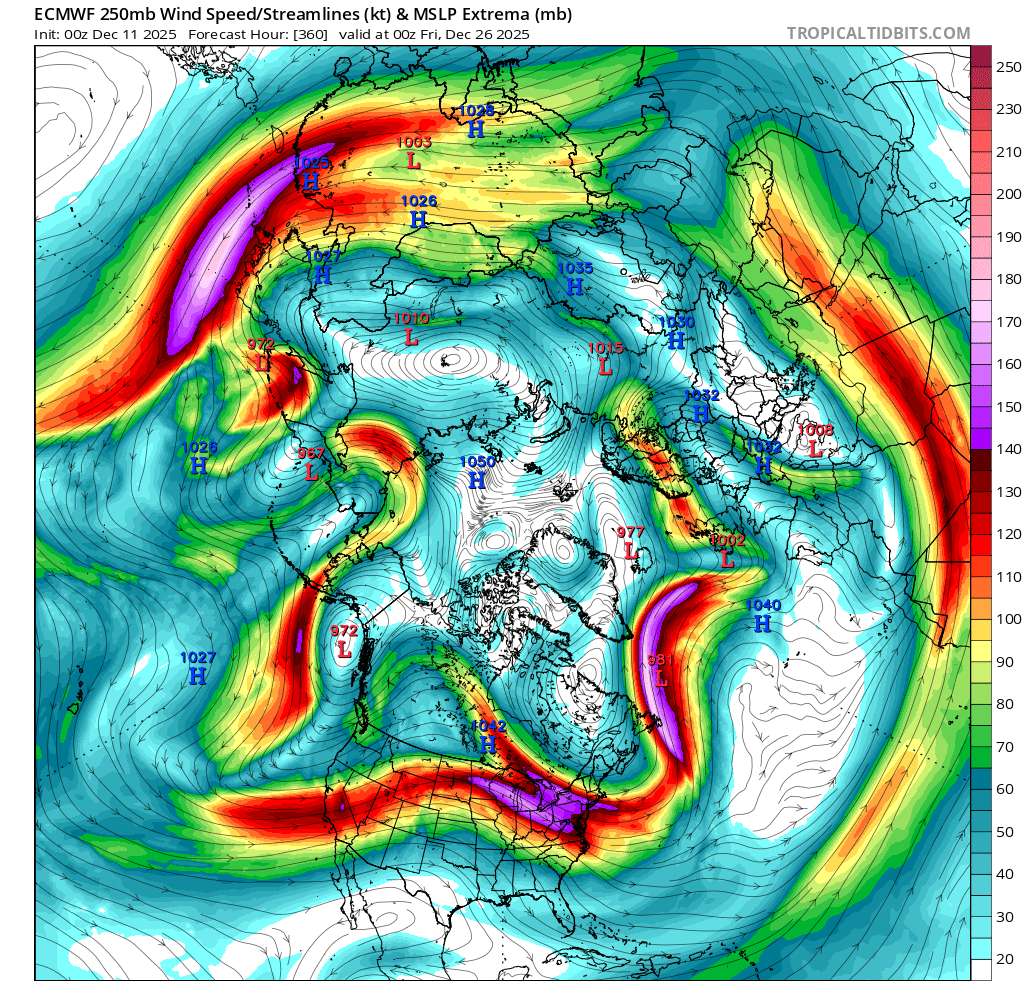
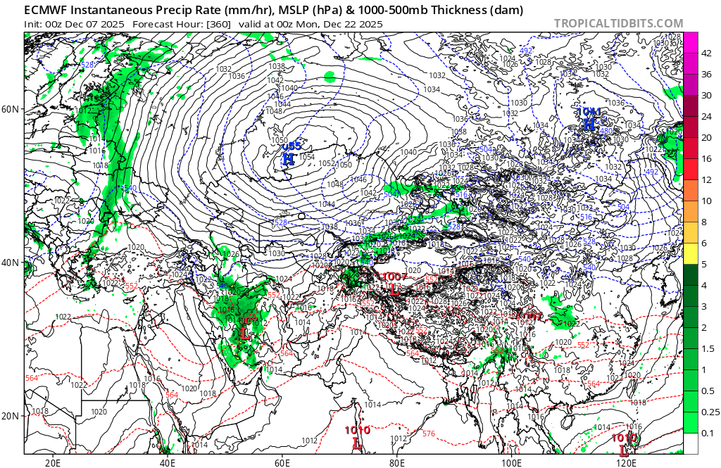
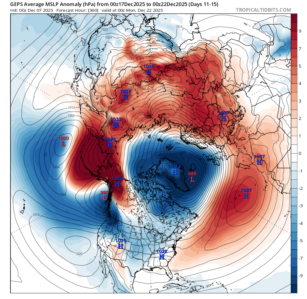
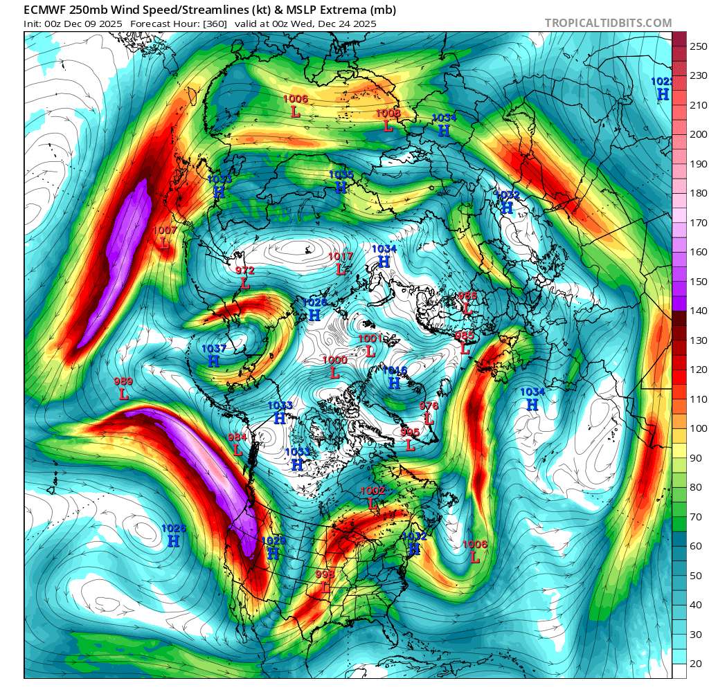
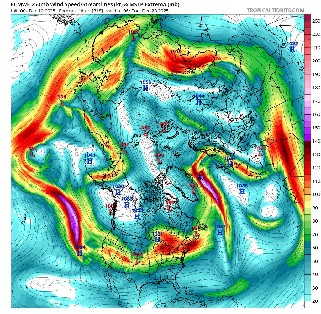
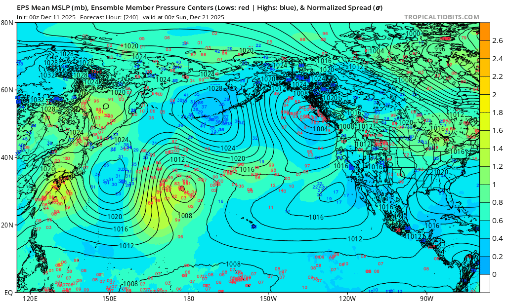
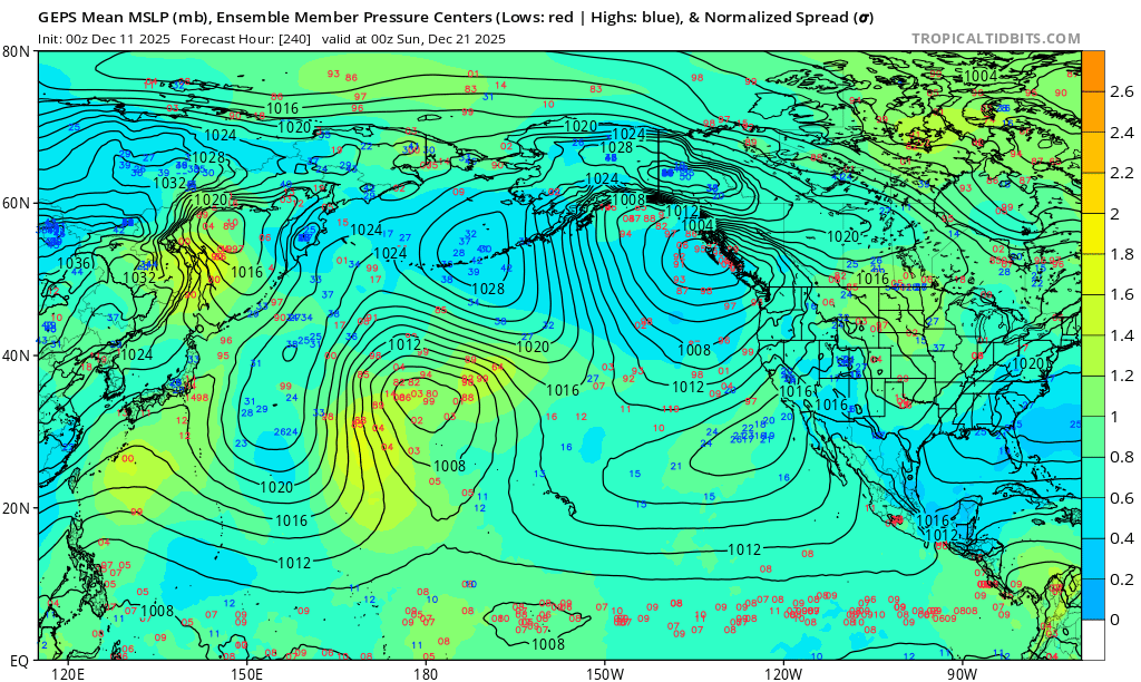
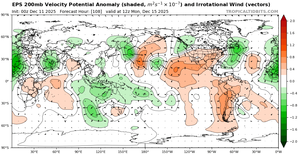
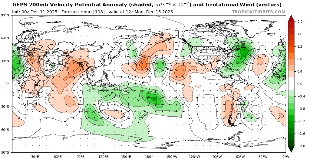
ECMWF det. seems on board but EPS looks less so. (charts from tropicaltidbits)
As GEPS does seem to have a relative cold bias for Asia from some few subjective observations I've done (even in its analysis fields), it is perhaps overdoing the cold spell. But EPS doesn't seem to have agreement how broad the high pressure system will be...
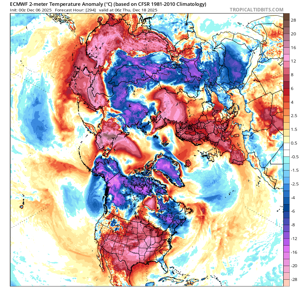
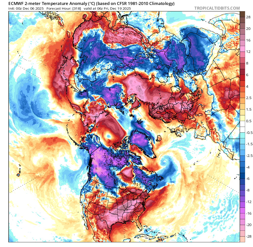
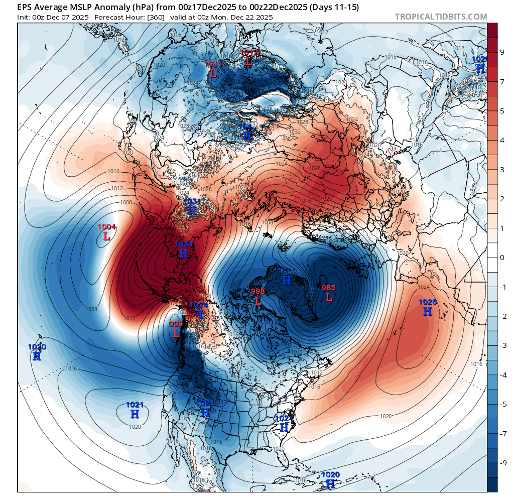
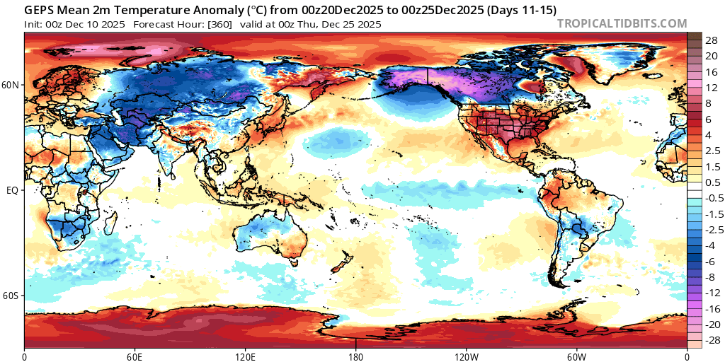
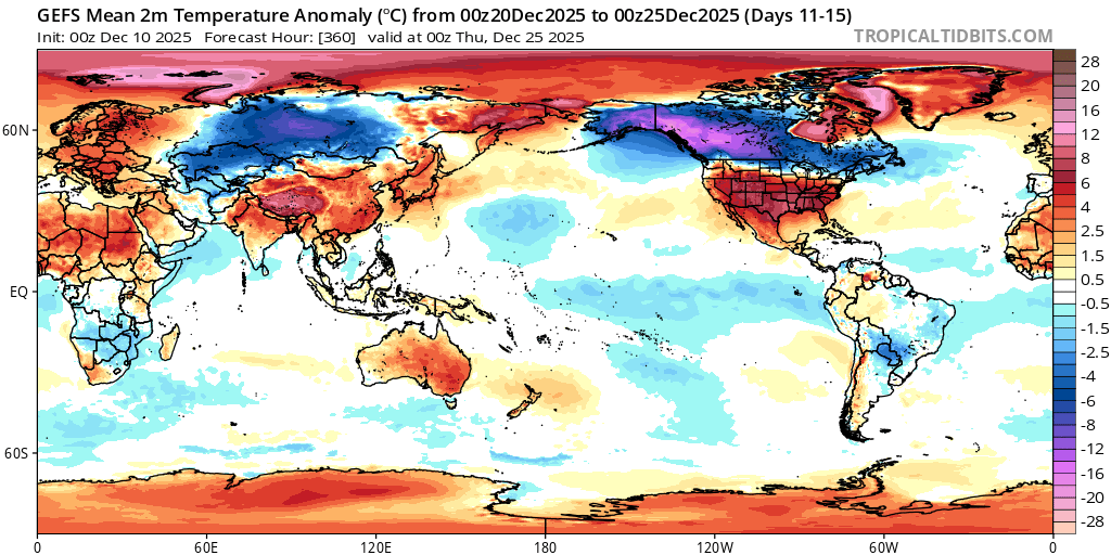
i.e. EPS 5 day and GEPS 5 day mslp average anomalies (ending 22nd)
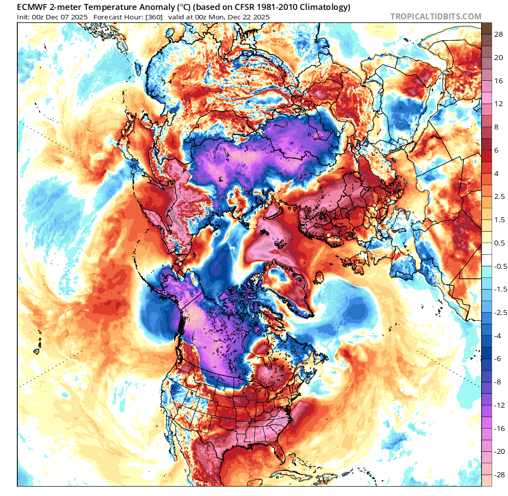
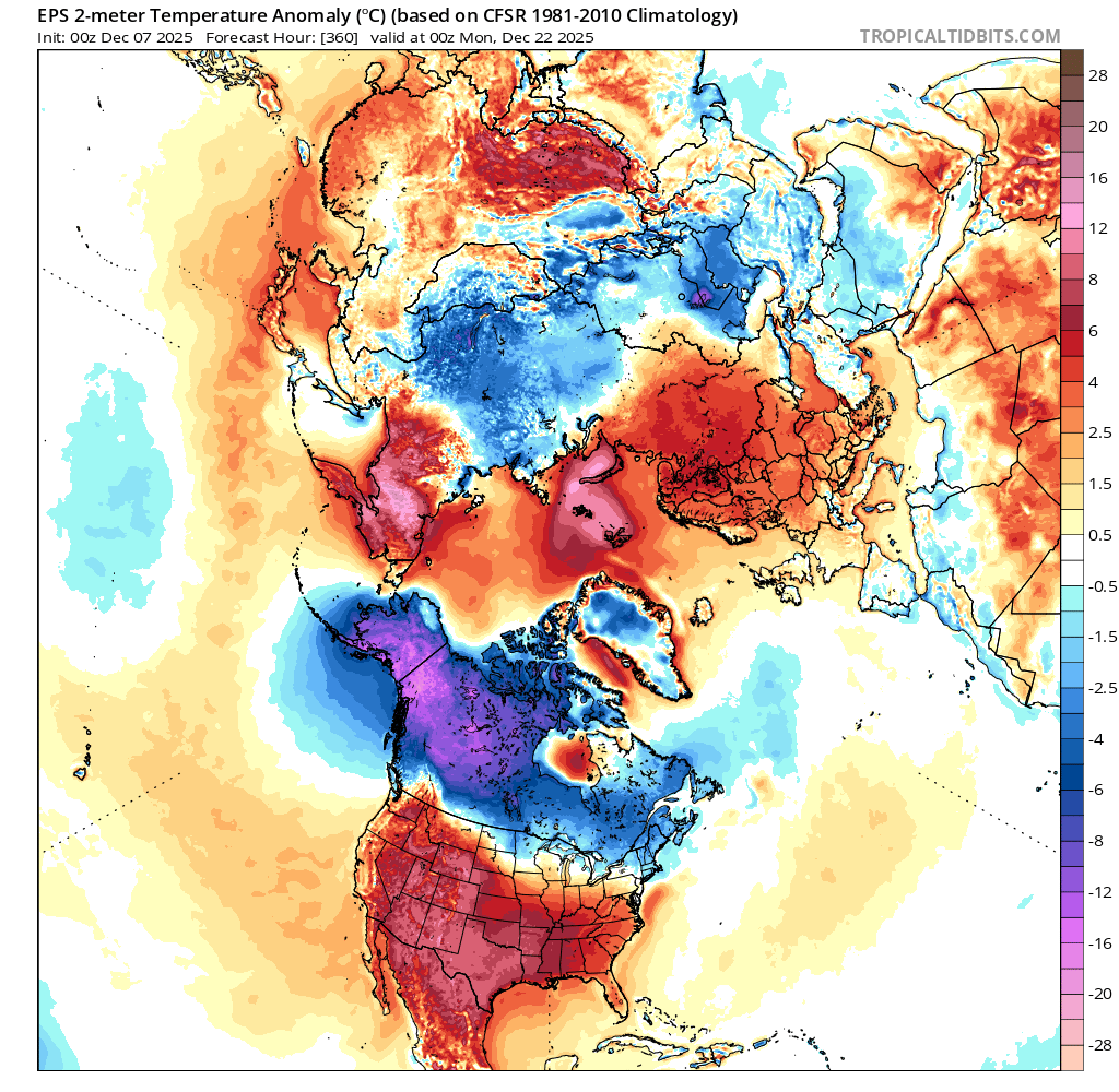
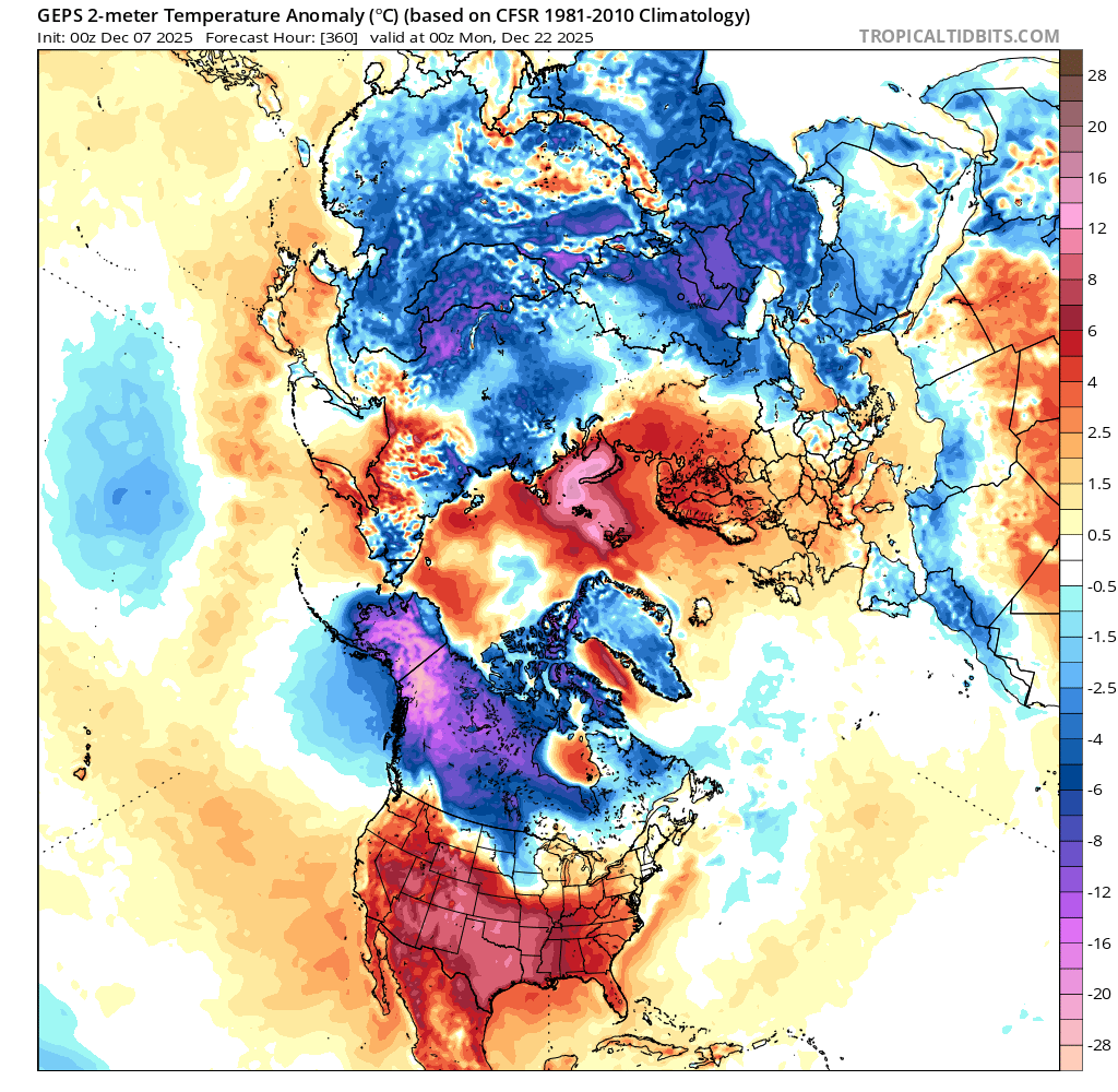
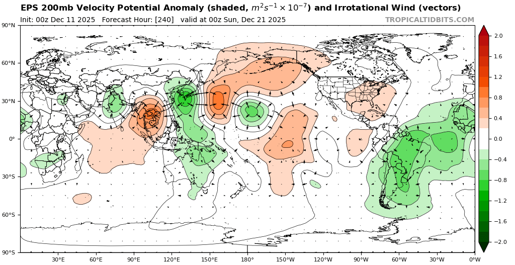
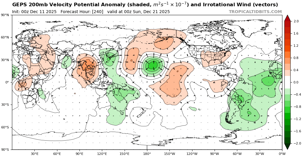
And t2m anomalies for EPS,GEPS on Dec 22....
The debiased and unbiased notebook has diverged a bit with the latest run (but only to the degree in the amount of further cooling, i.e. trending downwards further, at 1.03 and 1.06 C respectively after all adjustments).
Given that Prophet is extending from the start of possibly a cold spell for North America its not clear whether I should anticipate less cooling than it shows for the last few days of December, but at the least it seems more likely that the marginal trend downward will only turn flat or slightly reverse in the last 3-5 days I guess). The trend leading up towards the end of the forecast period is cooling for Asia in both GEPS and EPS/00Z averaged over 5 days so it seems likely to me the Prophet (climatological) trend is fairly realistic at the moment (at least for week 4).
The cooler dip now at the start of week 4 is explained below (at least by part into a cold spell for CONUS for week 4)...
I repeat again that the dynamic model (which is part statistical obviously for the last week) I have still is much colder than I have bet, while the pure statistical model is still very sensitive and has ranged from (1.11 today to 1.18 the other day), and given the prior for the month to month change in gistemp anomaly I still have not updated all the way downwards as I feel subjectively it will be based on my (largely speculative) expectations for week 3-5.
Based on the above and below though I increase my bet for a cooler December anomaly (now likely falling into the lowest bin), in the vein again of trying to be more aggressive betting prior to the middle of the month..

~
Below I speculate on the pattern for CONUS for weeks 3-5...:
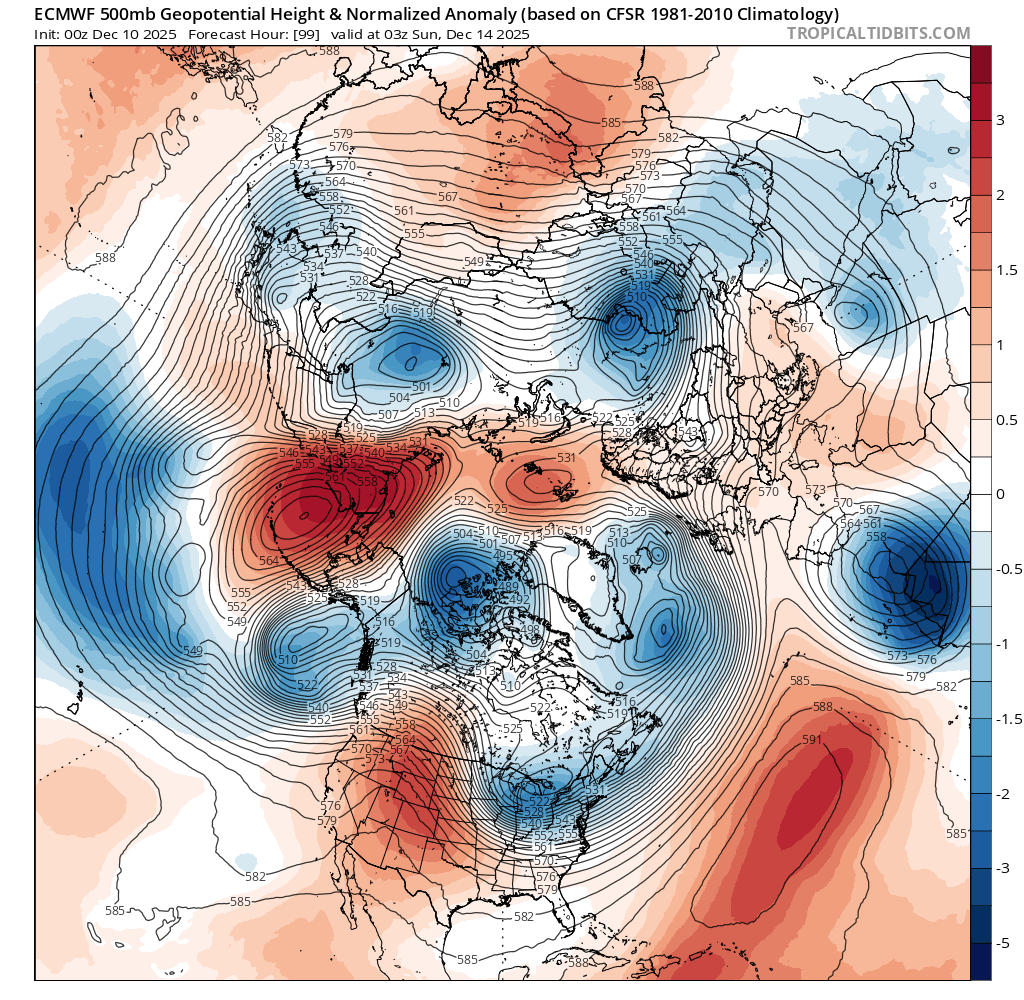
Det. ECM/00Z setup now has a AO- for week 4 that will reduce the blocking around NW US, allowing a cold air mass (that prior to pools around Alaska/NW Canada) to bring cooler temps across CONUS. (Previous runs showed blocking preventing this, so there isn't agreement yet on this scenario across runs)
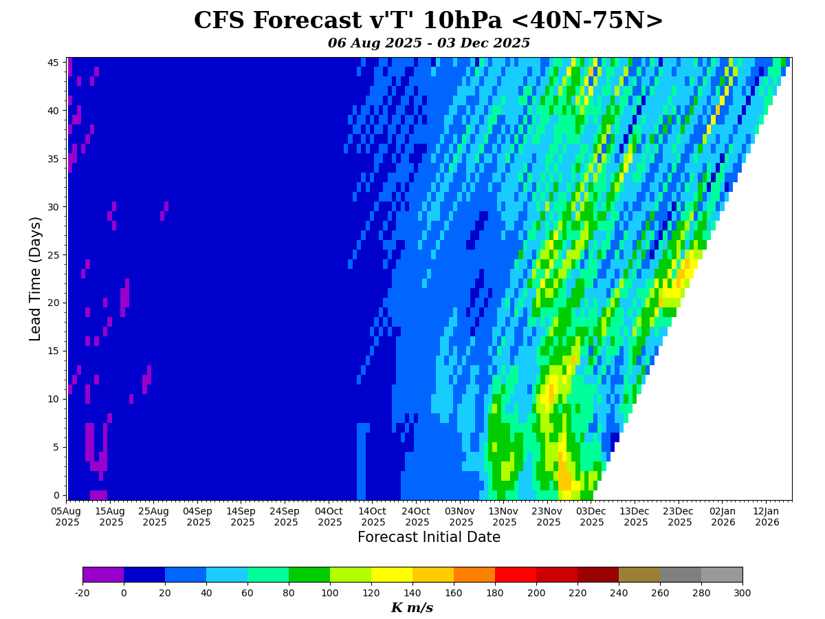
Given this weakening of the jet stream looks some what coupled to the vortex displacement about 9-10 days prior ..
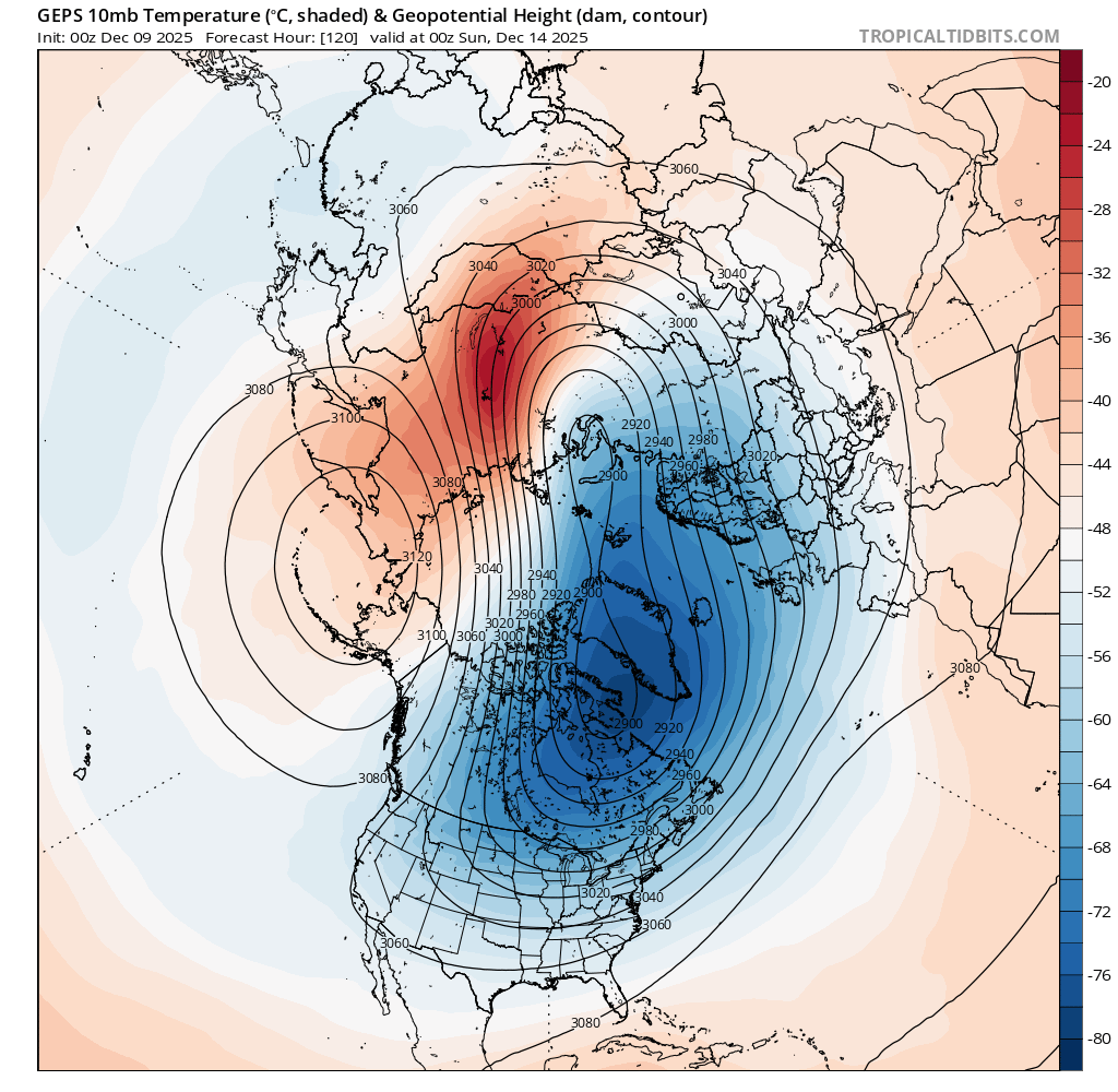
(GEPS above from tropicaltidbits, and GFS from CPC below)
from which the stratospheric polar vortex quickly recovers and strengthens again.. with the tropospheric jetstream being weakened to a minimum around the 23rd, lines up with the troughing setup to bring this cold air to the US (from which it also quickly recovers per GFS).
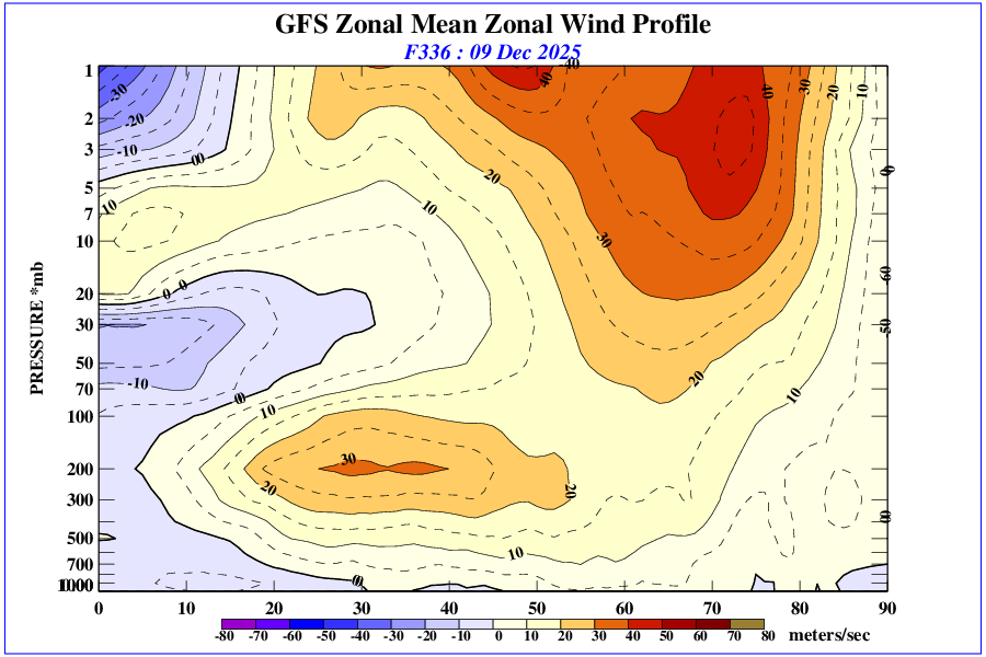
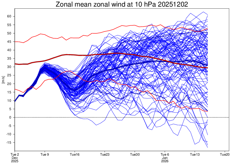
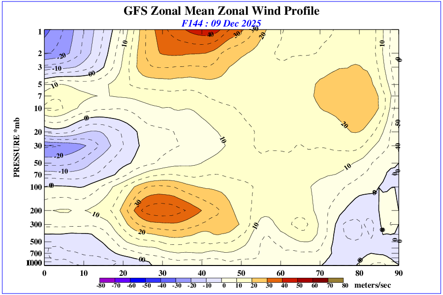
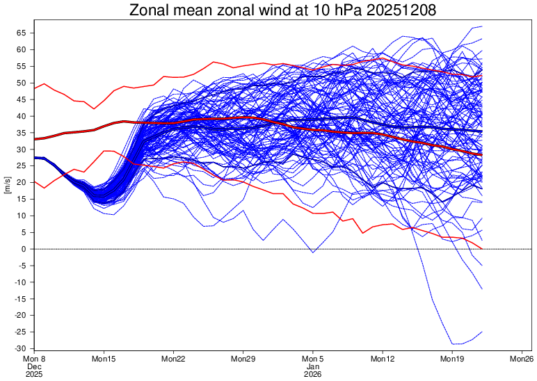
Zonal wind ensemble from long range EMCWF for stratosphere:
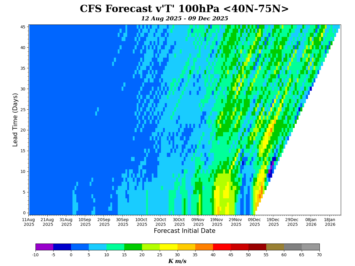
(edit) and the meridional eddy heat flux in a few days leading to the displacement of the vortex .... (CFS):
Keep in mind this is all far into the future and still not agreement on this story this far out even between runs... GEFS doesn't even agree on the AO becoming so negative but it does show a dip towards neutral at least, and EPS of course doesn't have such agreement with the deterministic model so far out with respect to CONUS scenario for week 4...
Since the longer range sub-seasonal models (both from NCEP and ECMWF) seem to agree on this setup (for now at least), it seems there aren't any stratospheric influence beyond the above mentioned that might increase the chances for another cold outbreak for the US for the last few days of December (or rather a sustained outbreak seems less likely for the last few days of the year), so it seems more likely at the moment that the AO will quickly return positive allowing for a more normal (climatologically) end to the year for CONUS (this is as best I can guess as a layman)...
Forecast continues to evolve for week 4 and end of December... overall looks from the ensembles like we will get some transient warming (a tiny bump) per the ensembles but speculatively a decent dip in week 4 and the end December. I haven't looked at historically how big of a month over month anomaly drop, but it's starting to get up there (closing to around 1.01 C or so after all adjustments) (this would be a ~0.2C month over drop in the anomaly if it validates)

A very quick glance at 500mb fields doesn't seem much has changed with respect to Asia (still expecting a significant high to develop over Siberia/Mongolia based on the ensembles, just a matter of where and how much), and usual large uncertainty for North America but trending cooler, and I am now, albeit speculatively, based on the NH though I'm no longer expecting any significant warm up for the last week of the year (this leads to more confidence in the lowest bin, and even more confidence it will fall in the lowest two bins; this is contigent on the SH ensembles also being largely on average accurate, i.e. whether GEPS validates for Antarctica or not will cause the forecast to be off (at this time I still think EPS or somewhere in between the two is more likely at the least).
Below I revisit SH as I haven't for a few days, and also look at the NH again....
~
SH:
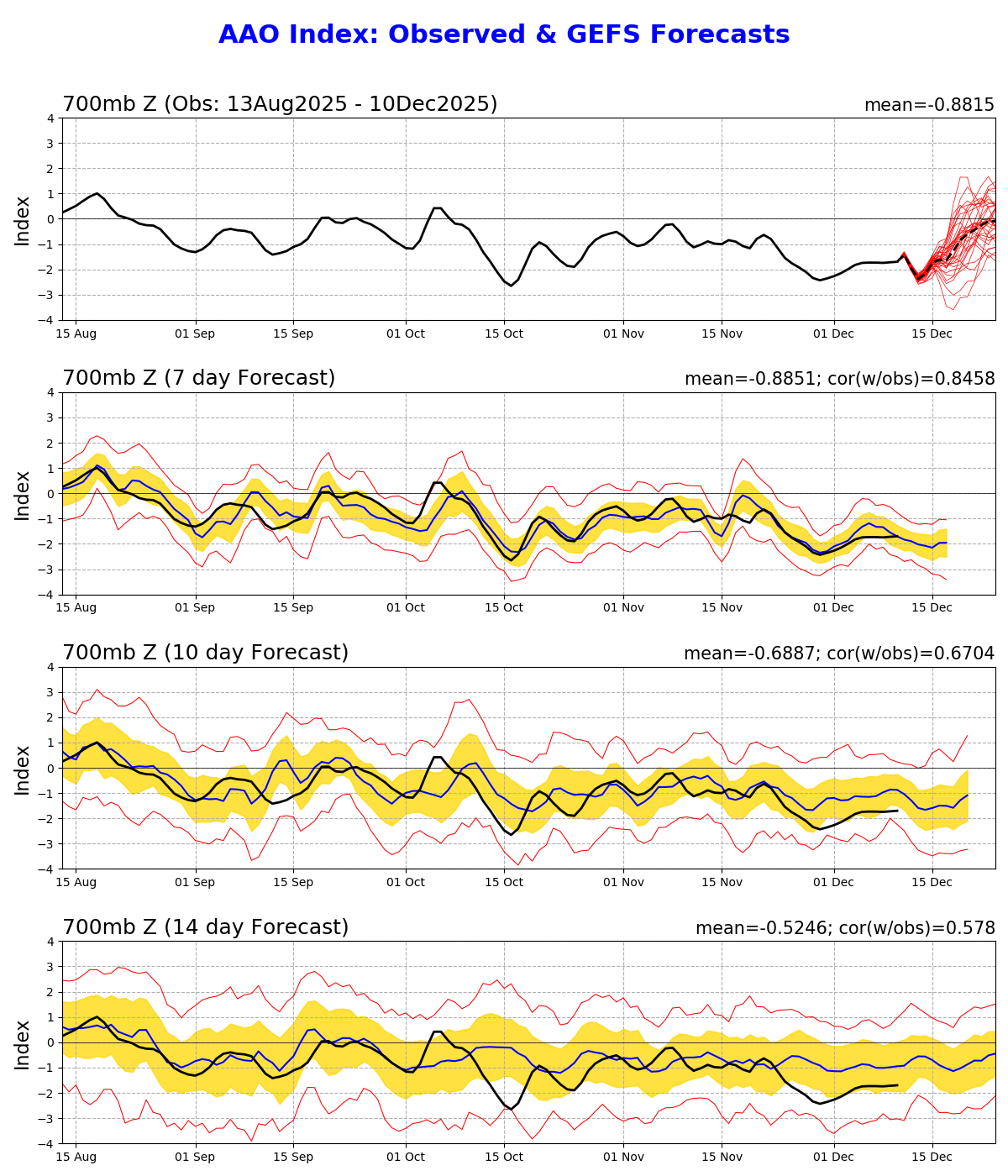
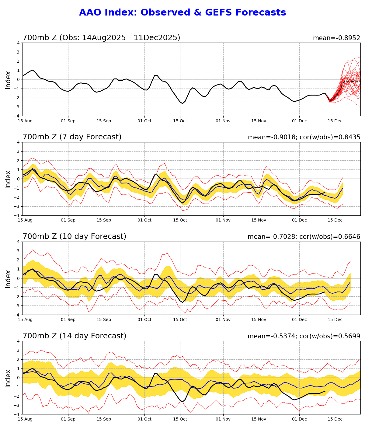
I spent very little time looking at the SH today and the last few days, but it seems there is a good amount of divergence between the ensembles (GEFS has a large spread in the AAO -- previously it looked like it might become slightly more neutral but stay generally negative towards weeks 3-4 if I recall correctly), but now the spread is fairly agnostic.. but averaging towards neutral...
Examining deterministic models and ensembles reveals a large disagreement for the SH over the next two weeks, especially over Antarctica. Looking at the ensembles, GEPS 5 day Z500 appears to show a much warmer/stabler SH overall, and the highs over Antarctica contributing to anomalously high temps (this is the scenario also in the det. CMC model for it)... GEFS shows less warming, and EPS even less warming (in fact ECMWF shows cooling over large parts of Antarctica)
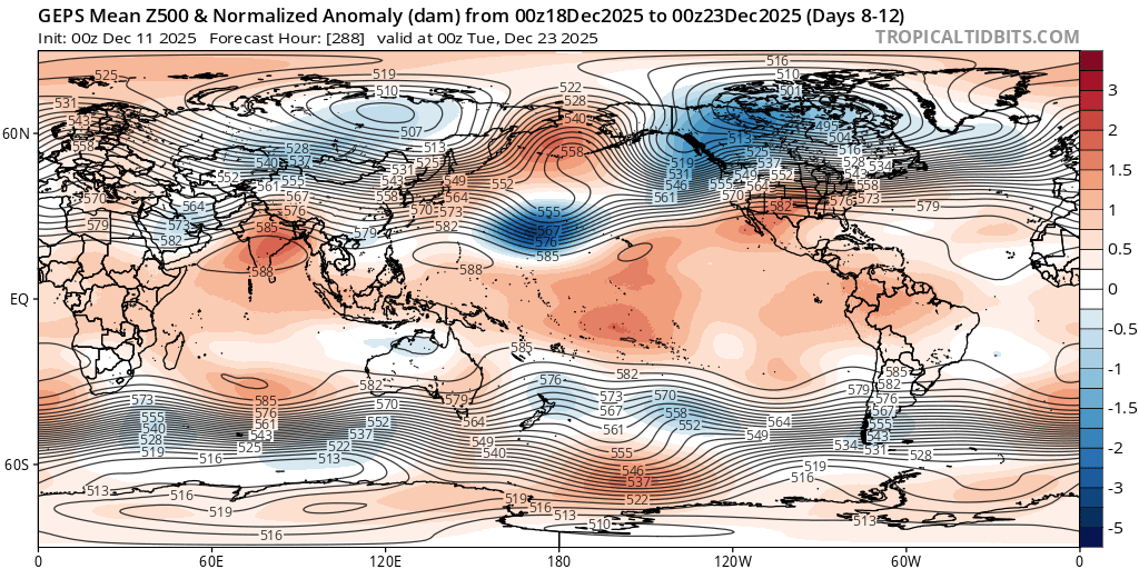
tropical tidbits charts for mean 500Z (normalized) anomaly for Dec 21-25 (GEPS is ~ 1 std dev over climatology for Antarctica) -- so if GEPS ends up being right, the trend (at least from the SH contribution) in recent super ensembles might reverse a bit when EPS picks it up... at the very least it is a reason to not update today so heavily despite the further negative trend.
Tropicaltidbits charts below in order of GEPS/GEFS/EPS since that is in order of declining heat extremes and positive anomalies for Antarctica...
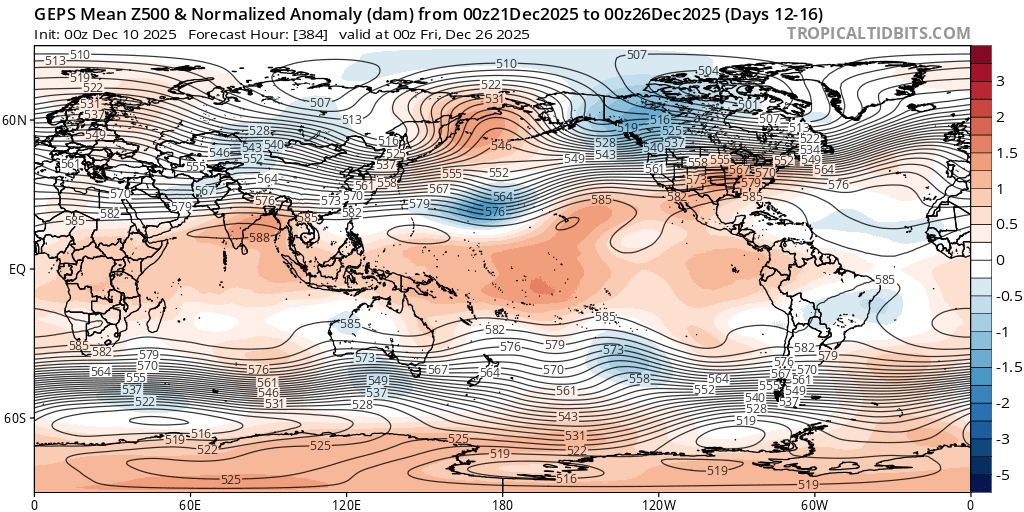
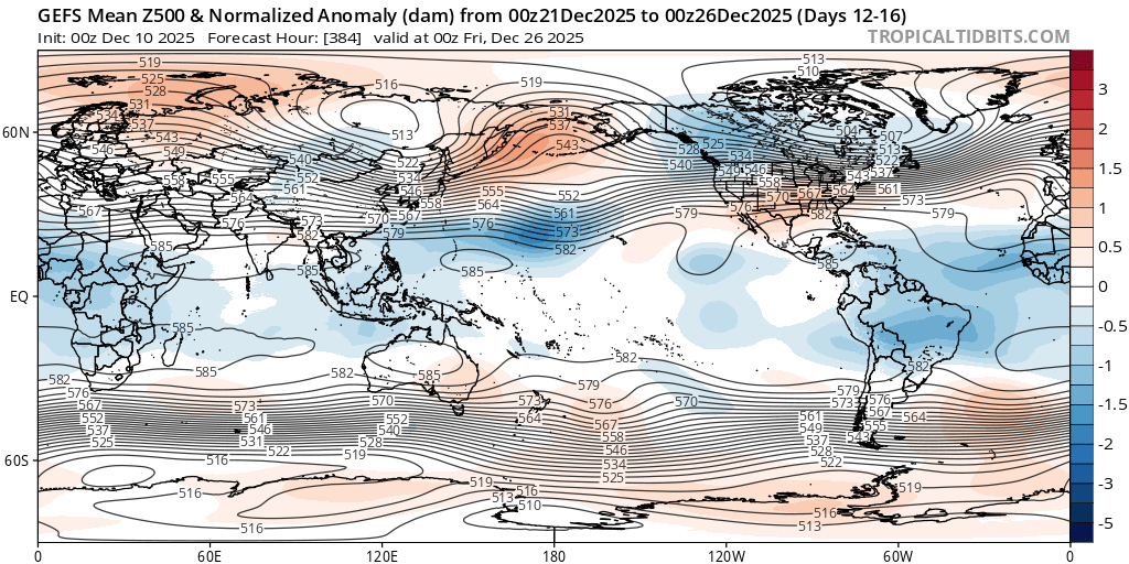
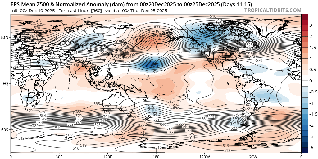
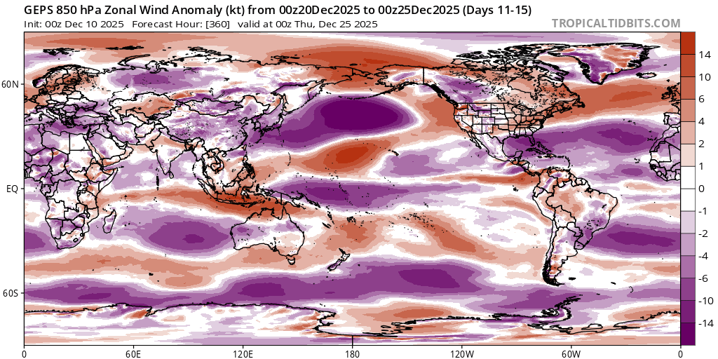
This and with the U-wind anomaly (and everything together) appears to indicate that GEPS disagrees to a larger extent compared to GEFS and EPS with the scenario of the AAO trending towards neutral or even positive (usually AAO+ would indicate a negative pressure anomaly over Antarctica, rather than AAO- and a positive pressure anomaly over Antarctica which GEPS is forecasting in the medium range...)
Compare the resulting temps for Dec 21-25...
~
NH:
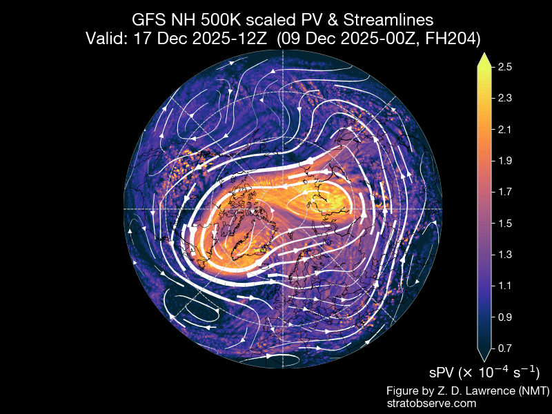
stratobserve is again working....
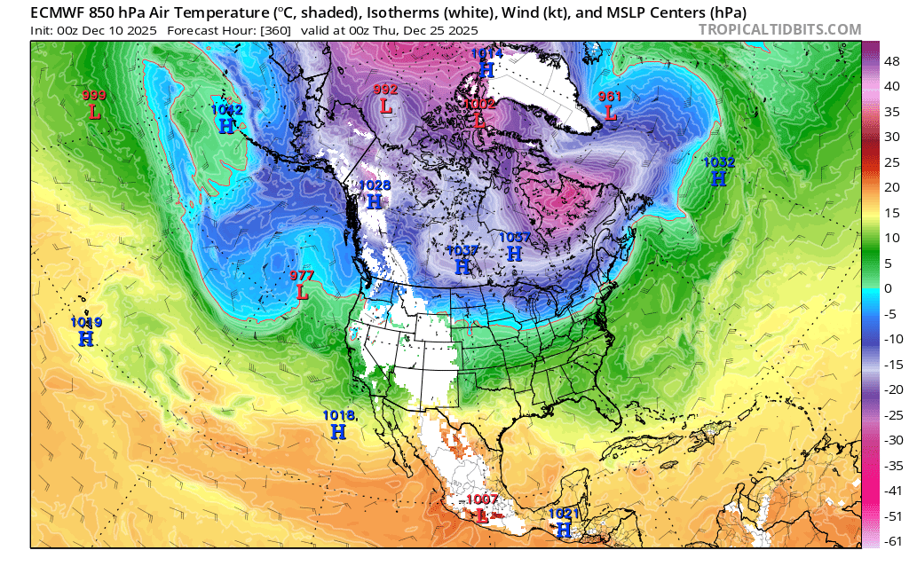
Following the consequent of the stratospheric warming event over the next week...
It's still not clear the exact timing and how much the lower stratosphere polar vortex will rebound (as GFS for instance today and yesterday indicating a strong rebound). Overall the models seem to indicate towards a (temporary?) displacement in the next week (from Scandinavia towards Greenland). Looking at GFS charts on stratobserve it appears that while there is a clear displacement in the lower stratosphere, given the setup in the tropopause and upper troposphere, this results in the tropopause with two different lobes of PV in a week from the displacement.
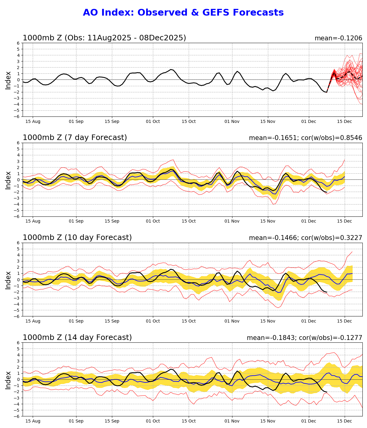
If this plays out like this, it seems the PNA will get more negative as a result, and the AO- should also become more negative (although the AO- is forecast to become positive it does become more negative in the GEFS forecast; so with the respect to the end of the medium-range mean 250mb wind ensemble maps they won't be nearly as zonal as they indicate). One thing notable is how anomalous the high over the Bering sea is forecast to become (~3 stddev)... and will remain there, apparently for a while ....
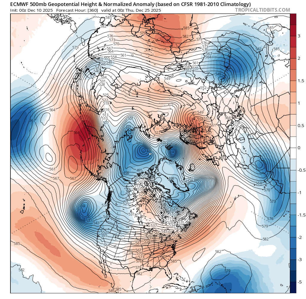
This should allow (temporarily at least, for week 4 of December) for some more splitting opportunities for the jet stream and depending on the timing of the vortex displacement, greater amplification from it should the opportunities arise.... But it looks like per the last ECMWF forecast any broad cold spell might be delayed a day or so compared to the last forecast assuming the troughing does manifest (still very far out?).
Can't expect consistency though this far out but at least in the latest forecast the jetstream is displaced a bit further south for week 4 and more zonal rather than a trough like yesterday's forecast.
Further speculative still.. even in this scenario the deterministic ECMWF shows a low offshore the west coast that might cross into North America before the end of the year to become a significant winter storm. These transient systems are the factors I think are the hardest to predict so it shouldn't be taken as a serious scenario so far out...
Late updating.. but marginal changes I need based on earlier 00Z...
Latest 00Z ensembles shows a more pronounced bump in the middle of the month compared to the last few runs... without checking I would guess from the AO forecasting to go more reliably positive then, this is likely a result of better confinement of arctic air... (i.e. compare the chart below, to the chart I posted 3 days that shows a less positive/more variable AO for the middle of the month).
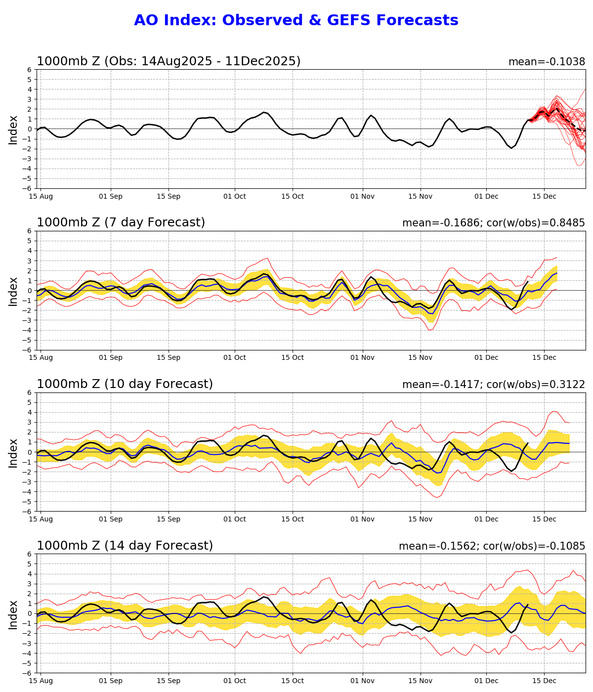
This results in the lining up of warm anomalies for CONUS, China-Mongolia, Europe, and a slightly larger Arctic anomaly. Afterwards the AO trends towards neutral or negative, and similarly we see a decline in the temps for the super ensemble... However (below analysis) shows possible tropospheric forcings for the later decline in temps for the last week or so of the month (more speculatively: allowed or even amplified perhaps by the stratospheric conditions mentioned previously for that time...)
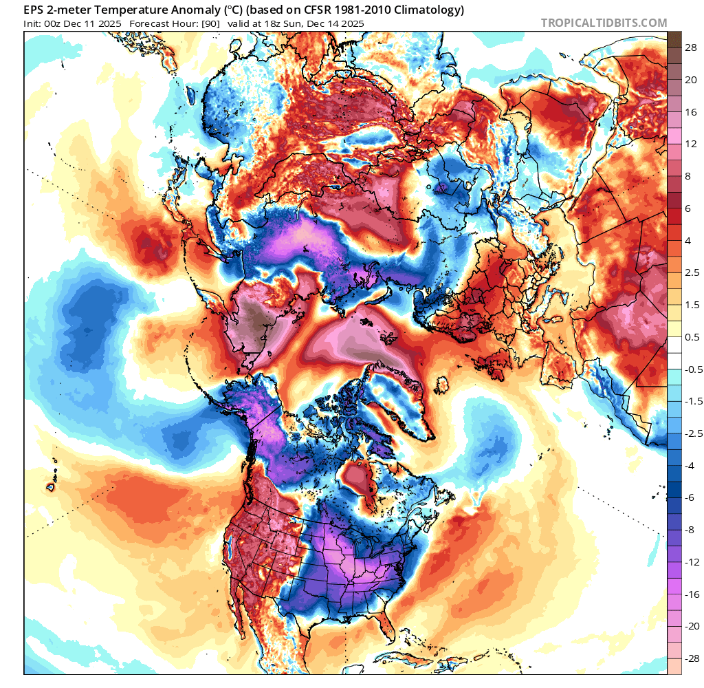
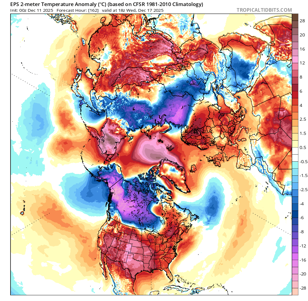
14th vs 17th (18Z)
~
SH: EPS does show some warm anomalies for the end of its forecast period but the high that GEPS develops is much later/weaker. AAO per GEFS continues to be agnostic for the end of the forecast period whether it will be positive/negative but with the mean slightly negative now; however it does show a sharper jump positive now over the next week compared to yesterday's run...
~
NH:
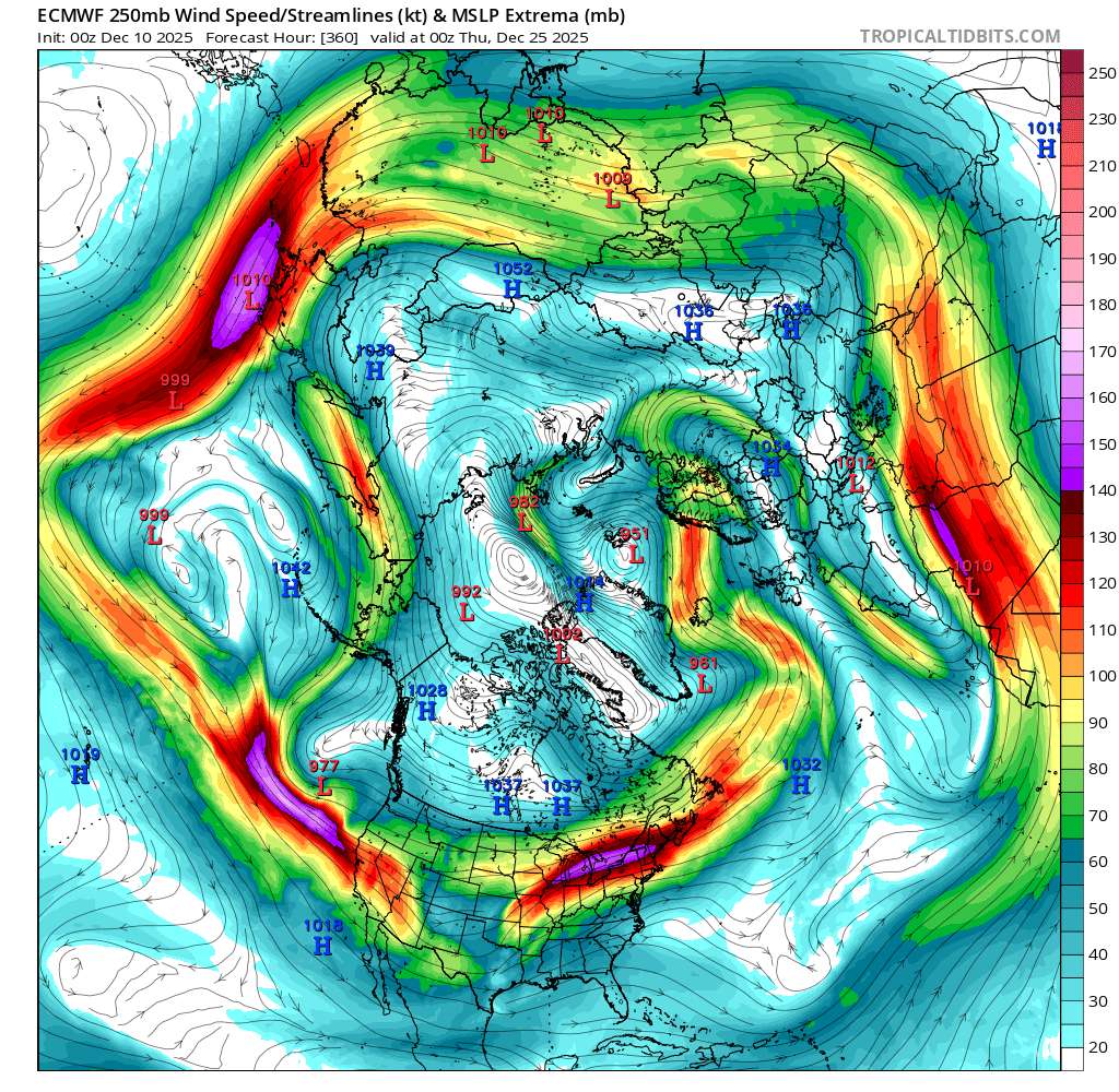
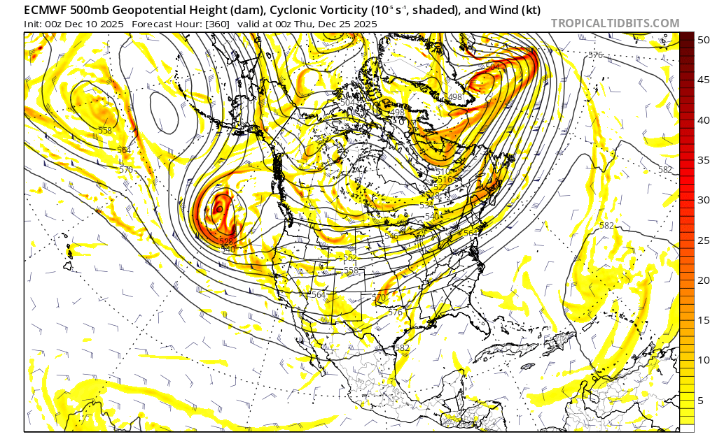
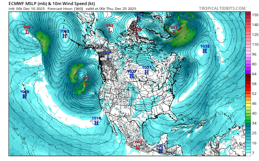
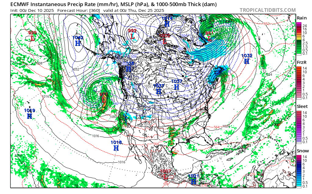
A closer examination of the models for the North Pacific from the ensembles shows that many of the members of the ensembles agree on a low pressure system developing in the North Pacific in about 10 days or so (i.e. deepening from ~ dec 21 to 23th) (some fairly deep, i.e. a 977 mb low I recall for ecmwf det.)
Comparing ecmwf. det and cmc through 10 days when I traced back its development I learned that they don't agree on how the low develops though or its timing.
One thing they do agree on is that there will be an earlier low develop there (in the central Pacific) in about 5 days (they diverge on the timing and the evolution of that low but generally if I recall it either weakens / moves E/NE)
I did do trace back how CMC and ECMWF develop their lows (the later low I first mentioned, around the 18-23rd) through day 10 but its too complicated for me to describe their differences in detail (in short, both show some contribution from some long wave energy from some troughing that develops in 5-8 days or so that results in a low a few days after, but differ in significantly in their timing (different origins), and also with respect to other whether there is additional short wave energy contributions for the development of the low like ecmwf shows)....
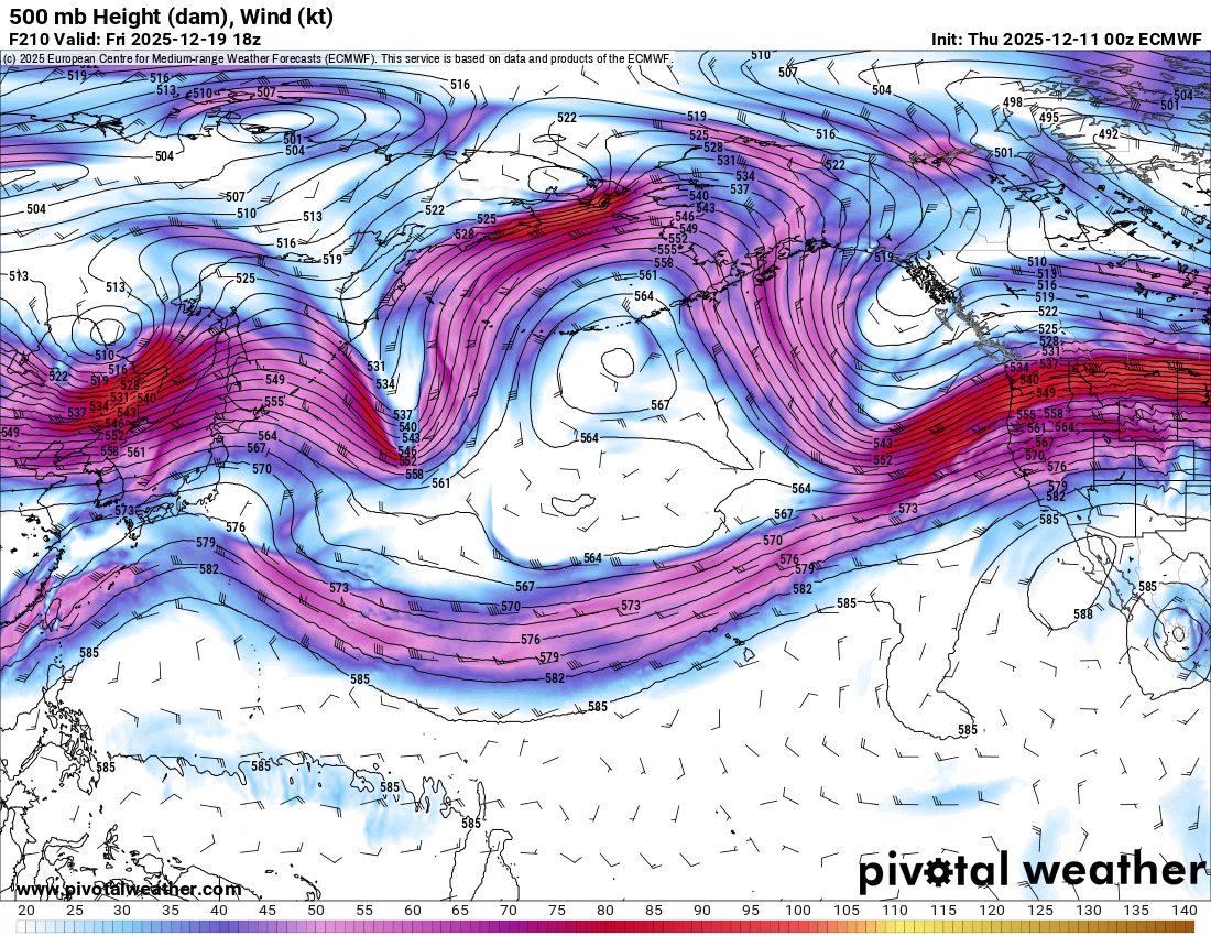
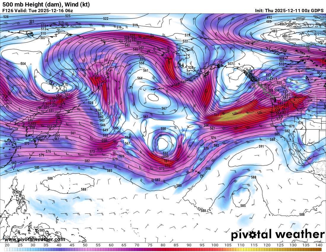
The reason for analyzing this is if the low deepens significantly enough (as it does in the ecmwf det.) scenario it can disrupt the jetstream (i.e. in the ecmwf scenario the low moves north and generates enough lift to disrupt the jetstream once the high pressure over the Alaskan Penenisula weakens a bit) and this leads to a more meridional flow downstream and greater cold (transient?) anomalies for different parts of the US for the last week of december or so.